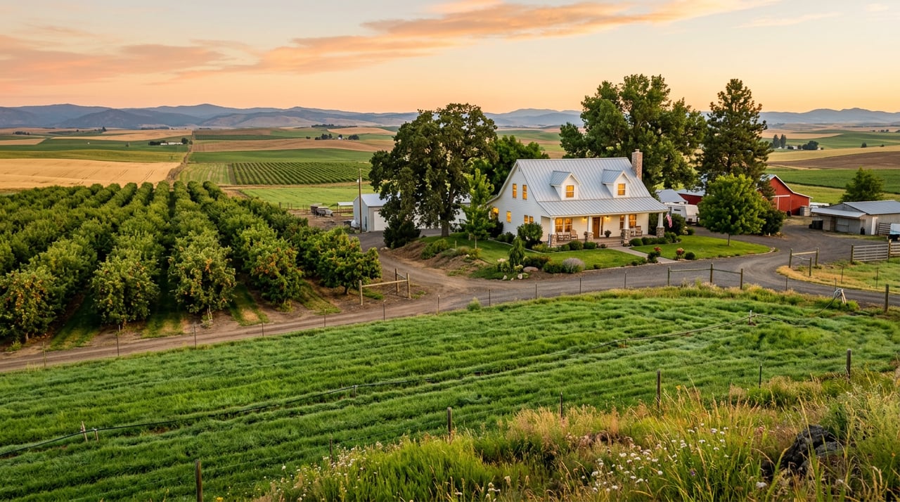
In Orchard City, "Irrigated" Doesn't Mean What Most Buyers Think It Means
September 24, 2026
September 24, 2026
Two five-acre parcels can sit half a mile apart on the same stretch of road outside Eckert and read like they were written for entirely different towns. One listing leans hard on the water: shares of the Surface Creek Ditch and Reservoir, irrigation rights spelled out in the first sentence, a note about gated pipe already in place for pasture. The other tells you the home has no electricity and no water hookup at all, just a permitted, hand-dug well and a promise of quiet. Same soil, same views of the Grand Mesa, same general mile marker. Completely different relationship to water.
Buyers scanning acreage across Eckert, Austin, and Cory, the three communities that make up Orchard City, tend to treat the acre count as the number that matters. It isn't. The number that actually determines what you can grow, what you can build around, and often what a parcel is worth is whether that land's water was declared into an irrigation district back when Franklin Roosevelt was in his second term.
Orchard City's origin story usually gets told as a public health fix. In 1912, the three unincorporated communities of Austin, Cory, and Eckert consolidated so they could pool enough money to build a domestic water pipeline, because residents were getting sick drinking straight from irrigation ditches. That solved the drinking water problem.
It didn't touch the orchards.
Agricultural irrigation in the Surface Creek Valley, which stretches from Cedaredge down through Eckert, Cory, and Austin, runs on a completely separate system that wasn't built until 1939, when landowners formed the Orchard City Irrigation District. OCID exists to manage water stored in Fruitgrowers Reservoir, a reservoir built by the U.S. Bureau of Reclamation about two miles east of Eckert, along with flow water moving through the district's ditches. The domestic pipeline keeps the tap running. OCID is what keeps an orchard alive. They have never been the same infrastructure, and a buyer who assumes one guarantees the other is starting from the wrong premise.
Here's the detail that changes how you should read an "irrigated" listing in this valley: OCID's water was never designed to fully irrigate anything on its own.
When the district formed, landowners who wanted in had to declare how many acres of their land they wanted irrigated with OCID water. The total declared at the district's founding came to just over 2,700 acres, and that declared number, not the acreage on today's parcel map, still governs how much water a property is entitled to draw. Your annual allotment is roughly proportional to a share of water that, in a good year, would deliver about one cubic foot per second for each acre of OCID water you own.
The reservoir was only ever meant to supply about half of what a crop actually needs. The rest was supposed to come from somewhere else, whether that's direct flow water, a well, or a second irrigation source entirely. So a parcel can carry a fully valid, fully declared OCID water right and still fall short of what a buyer pictures when a listing says "irrigated acres." The declaration tells you the land has a claim on some water. It doesn't tell you the land has enough.
OCID's service area has hard edges, and they don't follow property lines the way you'd expect. The district's boundary runs south from Eckert to the Gunnison River, with State Highway 65 marking the western edge and an imaginary line running from Austin up to Fruitgrowers Reservoir marking the eastern edge. A parcel that falls just outside that boundary, even one a few hundred yards from a neighbor with full OCID rights, has no claim on Fruitgrowers Reservoir water at all, regardless of how green the listing photos make it look.
There's a third layer to this, and it's the one that trips up buyers who think they've already done their homework. Some properties inside OCID's boundary also hold shares in water stored higher up, in the streams and lakes on Grand Mesa. This supplemental water is not the same water sitting in Fruitgrowers Reservoir and isn't owned by OCID at all. It moves down through either the Fogg Ditch or the Butte Ditch, and only reaches a property if that property separately holds the right to carry water through one of those two ditches. The whole arrangement is administered by the Grand Mesa Water Users Association, headquartered in Cedaredge, entirely apart from OCID's own board.
In practical terms, that means a parcel in Orchard City can land in one of several very different positions: full OCID declared acreage plus supplemental Fogg or Butte rights, OCID acreage alone with no supplemental backup, supplemental ditch rights without any OCID declaration, or none of the above and a private well doing all the work. Four parcels, four completely different water pictures, and nothing about the acreage number tells you which one you're looking at.
| Water Source | Who Administers It | What It Typically Covers | What to Verify Before You Offer |
|---|---|---|---|
| OCID declared acreage | Orchard City Irrigation District board | Roughly half of typical crop water need, tied to acres declared at the property's inclusion in the district | Ask for the property's current declared acreage and whether it matches the deed |
| GMWUA supplemental water | Grand Mesa Water Users Association, Cedaredge | Additional flow water via the Fogg or Butte Ditch, separate from Fruitgrowers Reservoir | Confirm the property holds its own ditch-carrying rights, since these don't come bundled with OCID membership |
| Private well only | Well permit holder | Domestic and limited outdoor use, depending on permit type | Check whether the well permit allows irrigation use at all, and at what volume |
Fruitgrowers Reservoir does more than hold irrigation water. The reservoir holds around 4,100 acre-feet, and every fall it becomes a stopover for thousands of migrating Sandhill Cranes at Hart's Basin, celebrated locally with Eckert Crane Days. It's a nice reminder that the same infrastructure quietly deciding whether your future orchard gets watered is also one of the better birdwatching spots in Delta County. Worth a drive out even before you've settled on a parcel, if only to see the thing that half your water math depends on.
Before you fall for the view or the price per acre, get specific about water in writing. Ask the seller or their agent for the property's current declared OCID acreage and whether that number has ever been reduced or transferred separately from the land. Ask whether any Fogg or Butte Ditch rights are attached to the parcel, or whether that's a separate share you'd need to acquire on your own. If there's no ditch or reservoir water at all, ask to see the well permit and find out whether it's classified for irrigation use or household use only. None of this shows up cleanly in an MLS description, and all of it changes what the land can realistically do for you.
Does a listing that says "irrigated" guarantee OCID water? Not necessarily. Some properties are irrigated through private wells, through GMWUA supplemental rights with no OCID declaration at all, or through a mix of sources. The word "irrigated" describes the outcome, not the specific right behind it.
Can I add OCID or supplemental water to a property that doesn't currently have it? Water rights and district membership in this valley are tied to specific parcels and specific historical declarations. Adding water where none exists today is a real process with real limits, and it's worth confirming with the district and a water attorney before assuming it's possible.
Is a private well a reasonable substitute for irrigation shares? It depends entirely on the well's permit. Many rural wells in this area are permitted for household use only and legally can't be used to water pasture or orchard acreage at scale, so the permit language matters as much as the well itself.
Acreage in Eckert, Austin, and Cory can look identical on paper and behave completely differently once you're the one paying the water bill or watching an orchard through a dry August. If you're comparing parcels in Orchard City and want a clear read on what water actually comes attached to a specific property before you write an offer, the team at Needlerock Mountain Realty has spent years untangling exactly this kind of local detail. Find Your Place in Colorado.
Stay up to date on the latest real estate trends.
A home, a ranch, a mountain retreat, or a thriving farm—every property represents a different way of life. Our team is passionate about helping clients discover the land, lifestyle, and opportunities that make Western Colorado extraordinary.

NEEDLEROCK MOUNTAIN REALTY & LAND, LLC
[email protected]
OPEN HOURS
MONDAY - FRIDAY: 9:30 AM TO 5:00 PM
CRAWFORD OFFICE
380 HIGHWAY 92
CRAWFORD, CO 81415
(970) 921-5331
PAONIA OFFICE
236 GRAND AVE
PAONIA, CO 81428
(970) 527-5331